Ben Lui and Beinn a'Chleibh Hike
|
|
Where: Ben Lui and Beinn a'Chleibh from
by Tyndrum in central Scotland
Height: 3,707ft, 1,130m Ben Lui . 3,005ft,
916m, Beinn a'Chleibh
Ben Lui is situated 7 miles west of
Tyndrum village on the road to Oban, 62
miles northwest of Glasgow, next to the A85
road.
These Mountains have little Trail and
Wet Sections so are normally avoided by
Tourist Hikers. Waterproof Boots and
Gaiters will be needed all year, although
some people go up in trainers in hot
spells.
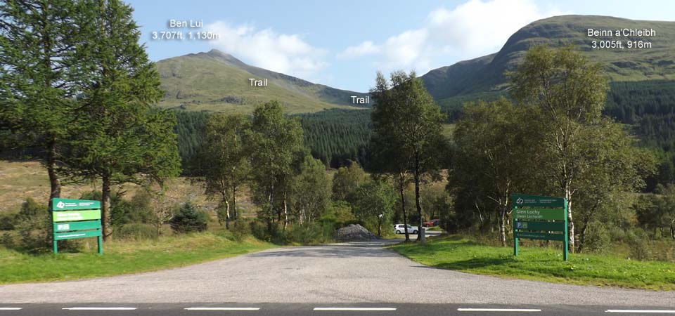
The image below is from the Glen Lochy
car park, 7 miles west of Tyndrum village,
next to the A85 road with a small charge,
pay by phone with 72 hours allowed to pay,
was £3 in 2025, a bit more for campers
over night.
This is the shortest route onto Ben Lui
and Beinn a'Chleibh, but is a bit tricky
due to having to cross a River, a Railway,
then up through a soggy forest Trail.
The Trail goes up through the Woodland,
up the northwest Ridge to Ben Lui, round to
Beinn aChleibh, then back down between the
Mountains.
Glasgow to
Tyndrum Village Road Map.
|
|
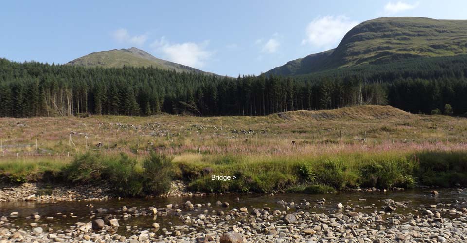
The image below is of the River Lochy
during a dry spell when easy to cross. If
it has been raining, you will need wellies
to cross or a pair of heavy duty bin liners
might do as boot covers, can leave them at
the other side till you come back.
Some people are now taking wellies and
boots, leaving the wellies at the top of
the boggy woodland trail, then getting them
back on when going back down the same
trail.
The most shallow part of the River is
straight down from the Car Park, then up to
the left 50 yards at a bend. Cross over
then follow the path right, down to the
Railway Bridge.
|
|
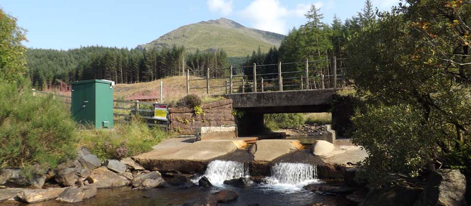
The image below is of the Railway Bridge
about 200 yards to the right after you
cross the River, may need Scuba Gear to get
under it if there has been a lot of rain.
You are not meant to cross the Railway.
|
|
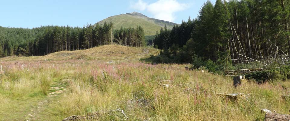
The image below is of the Trail up
through the Woodland, follow this Trail and
Burn all the way up to the top of the
Trees. The Burn will be right next to the
Trail all the way. Some people go up
through the trees next to the Trail at the
Boggy sections higher up.
They cleared the larger Trees here in
2013, with this pic taken in 2025 showing
what is left to be cleared once they are
larger.
Be interesting to see if they put a Path
in at the Boggy sections after they clear
the Trees as Ben Lui is becomming a popular
Mountain with Tourists.
|
|
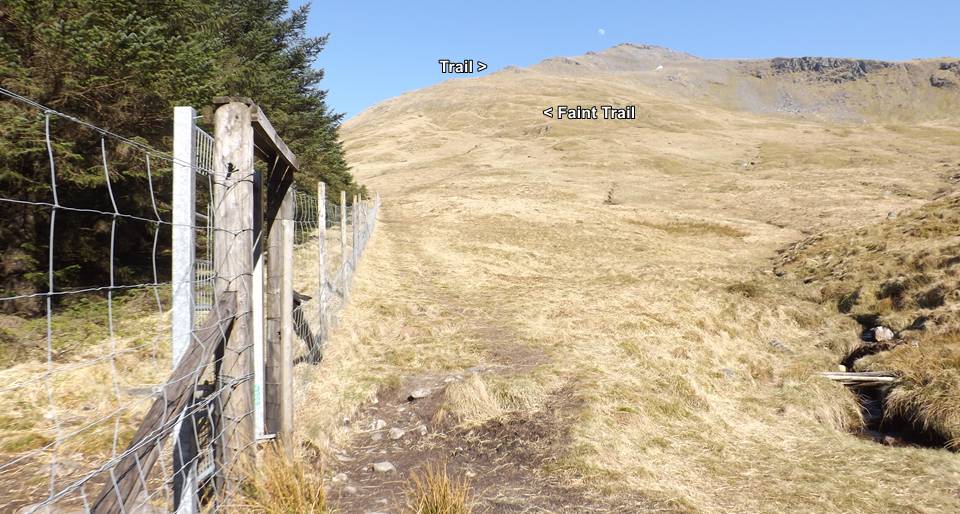
The image below is where the trail
through the woodland ends at about 1,500ft,
so about 2,200ft to go to the summit. There
is only a faint trail up towards the rocky
ridge, then there is a good trail to the
summit.
Some people hide their wellies in the
trees here then get the hiking boots on for
the top section.
|
|
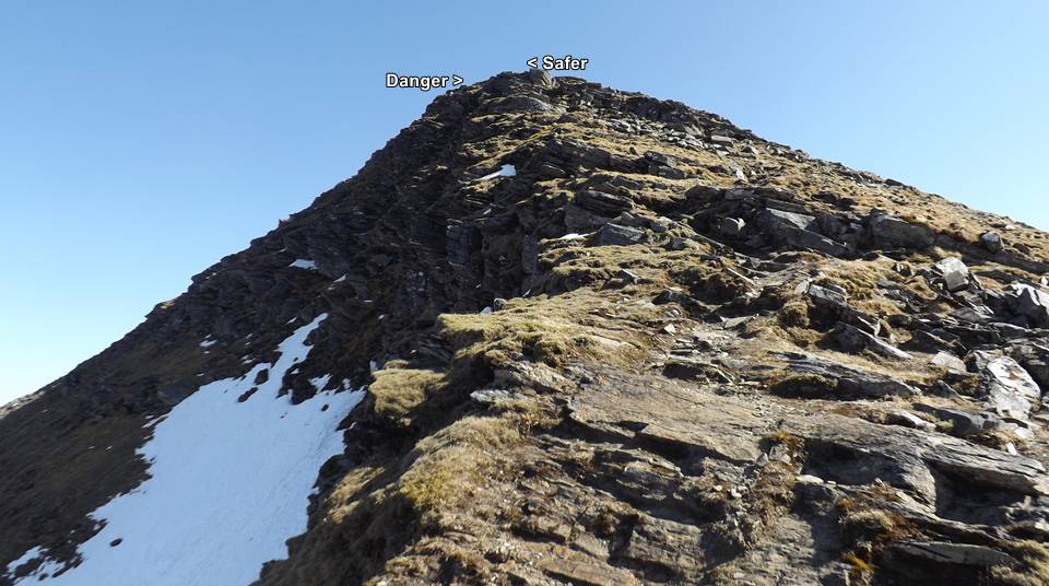
The steepest part of the rocky ridge has
two little scrambling sections, the one to
the left is over cliffs with ice on it up
to April, and another a bit to the right
that is a lot safer.
|
|
The summit of Ben Lui is one of the best
in Scotland, just watch out for the cliffs
all along the left side here.
|

|
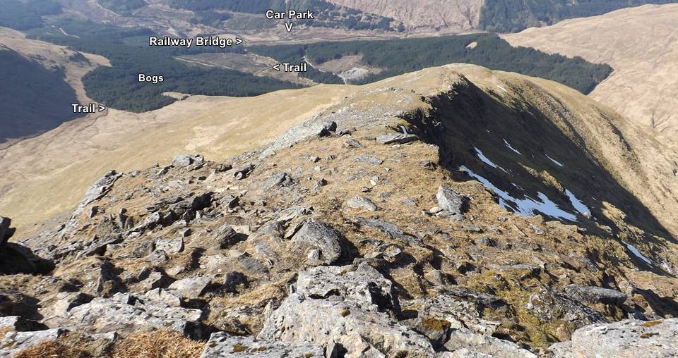
The image below is of the same trail
back down off Ben Lui showing the trees
that have been cleared and the ones still
to be cleared.
If going over to Beinn a'Chleibh, it is
a straight foward trail over, then go back
the same trail to the low point between the
mountains, then down a trail from there to
the same woodland path seen below.
Large Image
of the Beinn a'Chleibh trail.
|
|
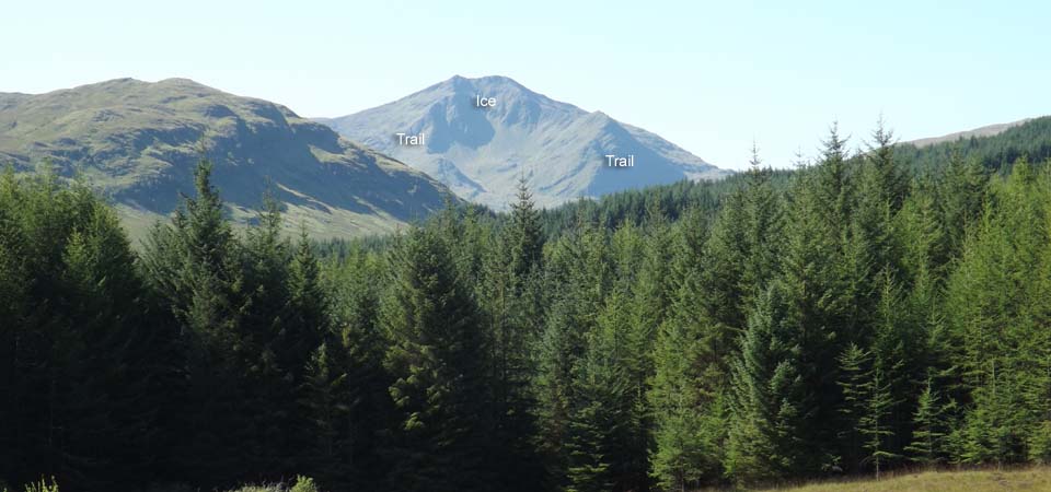
The image below is from the north where
there is a car park at Dalrigh, 1 mile east
of Tyndrum village next to the A82. This is
a less adventurous route onto Ben Lui, but
is a 4 mile hike or bike along a farm road
to the side of Ben Lui.
This route is best if there has been a
lot of rain, as the River Lochy may be
un-crossable at the Glen Lochy car
park.
This north side has two cracking Ridges,
also popular for Ice Climbing in winter as
it gets little sun, with Snow and Ice
between the two Ridges many months in the
year, known as the Central Gully. Ice Climb
Video
If going out this way, the left side
Ridge is the safest as is Solid Rock most
of the way, the right side Ridge has a few
steep sections with scree. Both ridges have
some danger, so best avoided by hikers with
little experience.
Large Image of the
two North Ridges.
Dalrigh is the main Car Park for the
3,375ft Ben Oss and 3,208ft Beinn
Dubhchraig.
|
|
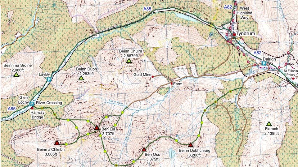
The Map below shows the routes onto Ben
Lui and Beinn a'Chleibh. Doing the four
3,000ft plus mountains here in one day is
real tough going. Getting dropped off at
Glen Lochy and picked up at Dalrigh would
make it easier. Using two cars is an
option.
Make sure and take an Ordnance Survey
Map and Compass on these hikes, and know
how to use them, as in cloud, these
mountains can be deadly. In Winter, make
sure you have Crampons and an Ice Axe, and
know how to use them.
Hill Walking OS
Map
Tyndrum Photo Tour
Ben Lui Photo
Tour to the Top from Glen Lochy with
many large images
Ben Lui Photo
Tour to the top from Dalrigh
|
|
|
