 |
Glasgow Home |
Glasgow History |
|
Glasgow History from the 600s to present day. The City grew from around the area of Glasgow Cathedral, spread south to the High Street and Glasgow Cross, then west to the Merchant City, further west to modern Glasgow centre around George Square, then west to Glasgow's West End. The City of Glasgow is about 10 miles across east to west, about 15 miles deep north to south. The City centre is now regarded as George Square, and about half of a mile in each direction around George Square. |
|
|
|
Glasgow Cathedral St Mungo had a Church built where Glasgow Cathedral now stands. Religion was key to building a City, as the Citizens were encouraged to follow Christian values, such as marriage, family life, live by the law, and pay taxes. Glasgow Cathedral was built from the late 1100s, the oldest building in Glasgow today. The Provand's Lordship museum is next to Glasgow Cathedral. This is the oldest House to survive in Glasgow, built in 1471. The University of Glasgow was founded in 1451 by Bishop William Turnbull, with the first classes taken in the Glasgow Cathedral buildings. The University buildings expanded over the following centuries, into a huge complex next to Glasgow Cathedral and the High Street. The present University of Glasgow building was completed in 1870, on the west side of Glasgow. Nothing of the Old University remains. Large Image of this area in the 1600s. |
|
The Tolbooth The High Street is one of the oldest Streets in Scotland, although most buildings on the High Street that can be seen now, were built around 1903. All that remains of the Tolbooth is the Tower in the centre of Glasgow Cross, as seen right. Glasgow Cross is where the modern City of Glasgow grew from. The area 200 yards south, is where boats would unload their cargo from the River Clyde, named the Saltmarket. Until the River Clyde was dredged in the 1800s, large ocean going vessels had to be unloaded at Port Glasgow, about 15 miles west, then the cargo would be transported up river in smaller boats. The area just west of the Cross, is where many Glasgow businesses were located, that became known as the Merchant City (Old Glasgow). The Tolbooth was used to collect Taxes for goods entering the Merchant City. The Tolbooth was also where most of the Public Hangings took place. The last person to be Hanged in public in Glasgow was a Dr Edward Pritchard that murdered his wife and his mother-in-law. He was hanged on Glasgow Green a short walk south of the Glasgow Cross in 1865. The Union between Scotland and England in 1707, led to Scottish merchants being allowed to trade freely with America and the West Indies, leading to great wealth for many companies, and the banks, particularly through tobacco, sugar, and slavery. Glasgow Cathedral, Provand's Lordship, Tolbooth Steeple, and the Tron Church tower, are the only buildings remaining in Glasgow from the 1600s, and before. |
|
|
|
The Trongate The spire on the left is the Tron Church, now used as the Tron Theatre. The building across the road is the Trongate Town Hall. The Trongate was devastated by fire in 1652, which led to strict building controls from then on. The Merchant City today, has a large number of resturants and bar diners. On the west end of the Trongate, is the start of Argyle Street, that in the 1700s, is where many wealthy businessmen from the Merchant City began building Mansion Houses. Argyle Street was only just being developed then. Some of the most notable Glasgow merchants were William Glassford, that Glassford Street is named after, William Cunninghame, whose town house is now the Gallery of Modern Art, and the Buchanan's, that Buchanan Street is named after. |
|
|
|
Argyle Street Argyle Street runs under Glasgow Central Train Station, then on into the Kelvingrove area in the West End, about 2 miles long. It is this area of Argyle Street, between the Trongate and Central Station, that the Glasgow merchants began building their Mansion Houses. Today, Argyle Street is a main shopping street. Argyle Street was originally named Westergait, and a few other names after that, but was re-named Argyle Street in about 1760, after the 3rd Duke of Argyll. The name Westergait, was probably when this would have been the western entrance into the Merchant City, so there would probably have been a Tolbooth here as well. |
|
|
|
Buchanan Street Over the next 130 years, most of the Glasgow centre that can be seen today, was built around Buchanan Street. This Street was named after the Buchanan's who were wealthy Tobacco Lords, with tobacco estates in America. The Buchanan's had bought the land for development of what would become modern Glasgow. They lost their wealth during the American War of Independence 1775-1783. This led to the Glasgow Bankers taking over the development of the Street. The Buchanan's had a Mansion House on Argyle Street, where Buchanan Street connects to Arglye Street. |
|
|
|
George Square The Glasgow Government departments then moved from the Tolbooth at Glasgow Cross to George Square, where the modern City of Glasgow was being developed around the Square, and to the west. Also built around the Square was the General Post Office building, Bank of Scotland building, and the Merchants House, where the Glasgow Merchants run their business to this day. Most of the buildings around George Square, and about 1 mile west, were built from the mid 1800s to the early 1900s, most about 5 or 6 floors high, a great collection of Victorian architecture, well worth viewing. Only a small number were ever demolished, to make way for more modern high rise buildings. |
|
|
|
Millennium Hotel The three Houses were converted to Hotels around 1878, named The Queen's, The Royal, and The Crown. The North British Railway converted the three Hotels into the Millennium Hotel in about 1908. Queen Street Train Station opened in 1842, on the west side of the Millennium Hotel, built by the Edinburgh and Glasgow Railway company to operate mainly to Edinburgh, and other towns north of Glasgow. The Buchanan Street Train Station that opened in 1850, was situated a short distance northwest for links to other northern towns. That Station closed in the 1960s, leading to Queen Street becoming the main Station connecting to the north. |
|
|
|
Glasgow Central Train
Station The Central Hotel, built around the Station, was completed in 1883. This is the largest of the two Train Stations left in Glasgow, the other being Queen Street. The large St Enoch Railway Station was completed for the City of Glasgow Union Railway in 1876. The St Enoch station was about 200 yards east of Central Station. That Train station was closed in 1966, demolished in 1977, to make way for new buildings, including the St Enoch Centre, a vast glass roofed shopping centre, with over 100 shops. |
|
|
|
West End of Glasgow The first prominent buildings in the area were the Botanic Gardens opened in 1842, in Hillhead, the Hilton Grosvenor hotel that opened in about 1850 on Grosvenor Terrace next to the Botanic Gardens, and the present University of Glasgow completed in the Kelvinside area in 1870 as seen here. The area was promoted by developers as a greener and cleaner place than the overcrowded City Centre. They built many high quality houses, designed by the top Architects from the area, attracting most of the business people from the City. Two streets overlooking Kelvingrove Park, named Park Circus, and Park Terrace, were modeled on Architecture in the City of Bath. Glasgow had been expanding rapidly west at that time, taking over the areas of Hillhead and Kelvinside in 1891, with them then becoming the West End. The main Street in the West End is Byres Road, with many bars and restaurants. This Street runs from just north of the University of Glasgow, northeast to the Botanic Gardens. Byres Road was originally named Victoria Street. After the area was taken over by Glasgow, the name had to be changed, as there was already a Victoria Street in Glasgow. |
|
|
|
River Clyde
Shipbuilding These two companies built many of the largest Passenger Ships in the early 1900s, and some of the largest Warships, such as the liners Queen Elisabeth, Queen Mary, QE2, and warships Hood, Duke of York, and Howe. The Govan areas population increased from 9,000 in 1864, to 95,000 by 1907. Today, with the decline in Shipbuilding, the population is about 66,000. It is claimed that over 25,000 Ships have been built on the River Clyde since the first Shipyard opened in 1712. Only one large Shipyard is still operating, the BAE Systems shipyard at Scotstoun, 4 miles west of Glasgow centre, building mostly Navy Vessels. This Shipyard used to be named the Yarrow Shipbuilders. Scotstoun House and Estate was owned by the Oswald family, until Shipbuilding took over the area in the 1860s. |
|
|
|
Glasgow Rangers Football
Club Rangers played at various grounds around Glasgow before their stadium Ibrox Park, in the Govan area, was completed in 1899. Ibrox is the second largest Club Stadium in Scotland, with a seating capacity of 51,082. Most of the supporters originated from the Shipbuilding communities in the Govan area. Both Rangers and Celtic, now attract supporters from all over Scotland, Ireland, and around the World. The matches between the two are claimed by many, to be the most competitive, and exciting of any derby football games around the world. rangers.co.uk |
|
|
|
Celtic Football Club The East End is situated east of Glasgow Cross and the High Street. The population in the area grew dramatically in the 1840s, after the potato famine in Ireland, Scottish Western Isles, and the Highlands, forced many people to relocate to Cities. The East End has retained a strong Irish connection. Celtic Football Club is now one of the largest clubs in the UK, with its 60,355 seat stadium being the third largest football club stadium in the UK, after Manchester United's Old Traford, and Arsenal's Emirates Stadium. celticfc.com |
|
|

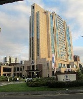
Glasgow Hotels Along with many Hotels in older buildings, they
are really busy throughout the summer, between
business trips and the vast numbers of tourists
visiting the City. One of the largest Hotels in
Scotland was built next to Central Train Station with
350 rooms for Motel One, completed in late 2017. |
|
|

Armadillo |
|
|

Glasgow Science Centre |
|
|

Cineworld Glasgow |
|
|

Riverside Museum |
|
|

Hydro |
|
|

River Clyde Walk |
|
|
|